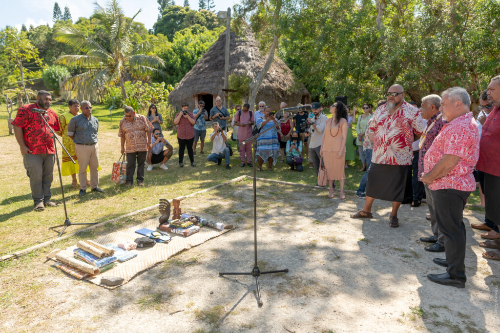
The Oceania Geospatial Symposium began with a traditionnal “coutume” at the Tjibaou Cultural Centre in the presence of officials. On this sunny Monday morning, New-Caledonia welcomed delegations from Polynesia, Wallis-and-Futuna and representatives of other island states and international organizations that are active in the geospatial fields. Here is a look back at a day that set the tempo for a “geomatician” week.
The Tjibaou custom, a link between past, present, and future
The sun was already high in the sky when Vaimu’a Muliava, member of the New Caledonian government in charge of innovation, digital transition of the administration, modernization of public action and the civil service, invited a group of representatives to go to the “natte coutumière”; first move, the prestigious guests placed their gifts on the “natte” under the eyes of our president, Mr Louis Mapou.
The ”coutume” began with speeches of representatives in a respectful and blessed manner; the representative of the French “Haut Commissariat” preceded the Polynesian Minister, Mr Heremoana Maamaatuaiahutapu ; then, it was Mr Stuart Minchin’s turn to speak before the official representatives of the Kingdom of Tonga, Samoa and Fiji spoke. The CNES and ART GeoDEV asked for the tribal blessing and reminded us of the values surrounding this event: “collaboration, community, sharing and sustainable development”. The die is cast, and the OGS has just officially launched its first edition.
Cit. “We must now look to the past to build together a canoe that will help us navigate the waves of the future through collaboration between all the Pacific states”. Heremoana Maamaatuaiahutapu
An introduction to geospatial observation as a decision support tool
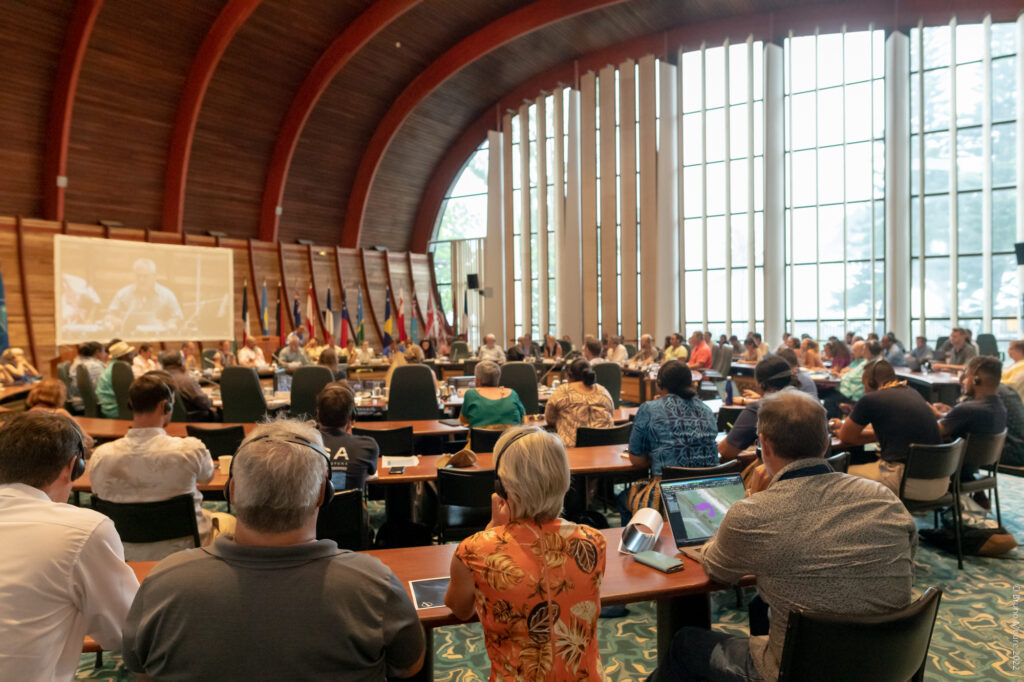
Back at 1:30 pm, in the Jacques IEKAWE conference room of the SPC, one of the main partners in this regional event. The right place to organize the first session of the afternoon. The conference is aimed at a broad and neophyte audience. Indeed, before entering the more technical conferences of the next few days, the OGS started with an introduction to the “geospatial” theme. Sachindra Singh, from the South Pacific Community (SPC), introduces this first part of the conference, soon followed by Jean Massenet, representative of ART GEODEV NC and central organizer of the OGS, who took over a few minutes later.
The objective of these two speakers was to explain to the audience the possibilities offered by space observation by providing specific and regional examples. First, Sachindra Singh reminded the audience that geospatial data and information are used to support the United Nations’ Sustainable Development Goals (SDGs). This plan called “The Future We Want”, launched in 2012 in Rio, includes broad sustainability goals in the themes of poverty eradication, food security and sustainable agriculture, energy, sustainable transport, sustainable cities, health, and population, and promoting full and productive employment.
Regarding geospatial data, both speakers presented concrete cases of the use of satellite images. They are becoming useful tools to better understand the evolution of territorial phenomena such as erosion, drought, landslides, forest evolution… More generally, these satellite images make possible to compare situations over time and thus understand the impact of a meteorological phenomenon (cyclone, tsunami, rising water levels, etc.). In other words, with the right analysis, geospatial data is able to determine the impact of human activity on the globe and help decision-makers to take appropriate decisions.
Cit. “What we see with our two eyes, satellites can see with 10 eyes. Each of these eyes has a different vision from the other and allows us to observe one phenomenon rather than the other. The only obstacle to this satellite imagery, especially for us in the Pacific, is cloud cover and our ability to find and train experts capable of analyzing these images. We need to transmit, exchange and share. Jean Massenet.
A beautiful opening ceremony to continue the day
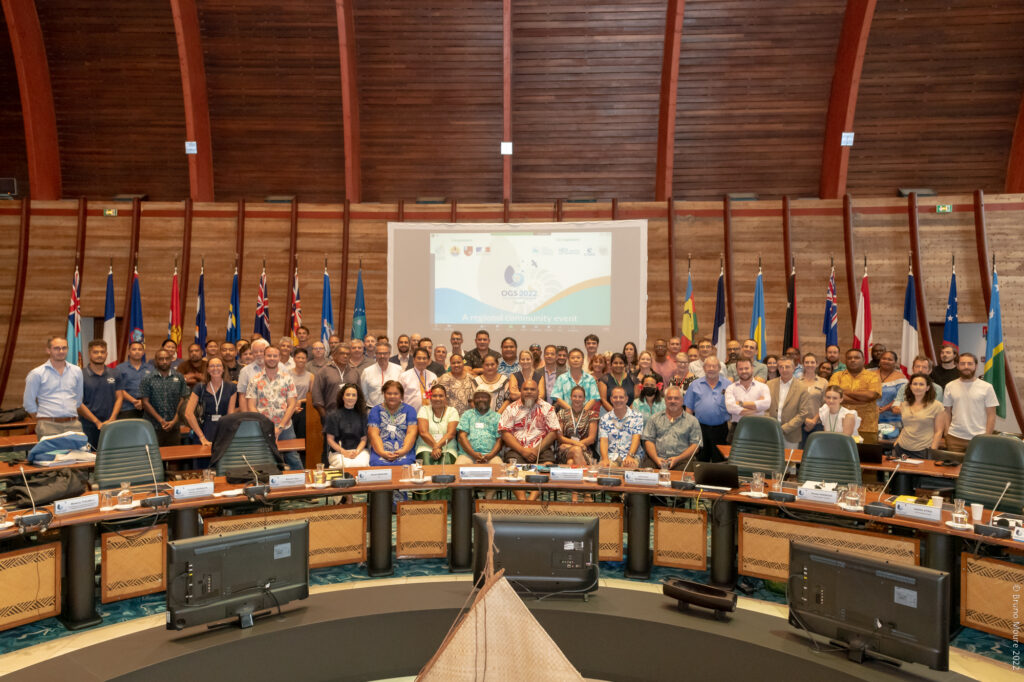
From 3 to 5:30 pm, the same (magnificent) Iekawé room, in the shape of a boat’s callus, was filled with speeches by the OGS stakeholders. Officials from New Caledonia, representatives from Australia, New Zealand, Wallis and Futuna, French Polynesia, Tonga and other organizations from here and elsewhere: all participated, with their words, in the opening ceremony.
Once again, Vaïmu’a Muliava took on the role of ceremonial officer; he distributed the words, not without a touch of humor or lyrical quotations. The Minister of Culture, Environment, Youth, Sports, and Handicrafts of the Government of French Polynesia, Mr Heremoana Maamaatuaiahutapu, opened the speeches: “We might think that geospatial science is far removed from our daily concerns, and yet it is one of the challenges of tomorrow’s world. The stars are once again a guide to our future.”
Then the President of the General Assembly of Wallis and Futuna, Mr Munipoese Muli’aka’aka, reinforced this speech by recalling the key word of this symposium: sharing! And all the participants added, in their own way, a word about their hopes and their joy of participating in this symposium on the ocean and geomatics. The speeches ended with an official photography of all the participants, and then three traditional dances from New Caledonia, French Polynesia and Wallis and Futuna, organized in the SPC gardens, closed this regional and multicultural session.
Mutualization and Oceanic synergies
With a little delay, another more technical sub-event began, “PICT’s territory and resources management policies”. In this respect, spatial observation is a formidable tool for territorial management through the knowledge it provides on the different terrains observed and their level of preservation. GIS – Geographic Information System – was mentioned here, QGIS there, and at some point, the conclusion was that all these technological tools must be used at the service of Pacific politics through the sharing of knowledges.
The day will end with an “ice breaker”, a small meeting of the personalities present and various audiences sensitive to this theme. This first day of the OGS was clearly a call for mutual aid and optimization of technological uses related to geospatial observation. By relying on their cultures and ancestral know-how, the Oceanian peoples now have a new tool, technology, which they must use to address their environmental challenges. This is what this first edition of the OGS is all about: “drawing on the roots” of the Pacific peoples to build a “new horizon”. Together.